ANM warns: there are three days ahead with heavy snow in the mountains and major risk of avalanches

The National Meteorological Administration warns that, in the next three days, heavy snow in the mountain area will significantly increase the risk of avalanches, especially at high altitudes, where the snow cover is unstable.
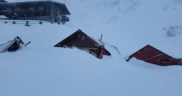
Increased risk of avalanches in the next few days. PHOTO: Dan Popescu
In the next three days, the mountainous area of Romania will be affected by consistent snow, which will lead to significant accumulations of snow and increase the risk of avalanches, warns the National Meteorological Administration (ANM) in a Meteorological Bulletin sent to Agerpres on Friday, January 2.
Făgăraș Mountains: high risk of avalanches above 1,800 meters
Between January 2, 20:00 and January 5, 20:00, in the Făgăraș Mountains, at altitudes above 1,800 meters, consistent snow will be reported, with local accumulations of over 20 centimeters. The strong wind of the past few days has resulted in the formation of wind slabs near the ridges, deposited over a layer of cup-like crystals with low adhesion.
In these conditions, the upper layer of snow will have little resistance and a weak connection with the lower layer, reaching thicknesses of 40–50 centimeters in places. On steep slopes, the risk of medium and even large avalanches is considered high, especially with overloads.
Below 1,800 meters: moderate but increasing risk
At elevations below 1,800 meters, snowpack is currently relatively low, but forecast snowfalls may bring additional accumulations of 10–20 centimeters. In these areas, snow flows or small avalanches are possible, especially between 1,500 and 1,800 meters, the risk being moderate.
Bucegi Mountains: increased instability
In the Bucegi Mountains, at over 1,800 meters, snowfalls will locally deposit another 10-20 centimeters of fresh snow, increasing the instability of the upper layer. The wind plates formed in the area of the ridges, placed over cup-type crystals, increase the risk of triggering small and medium-sized avalanches, both spontaneously and under overloads. The risk is significant.
Below this altitudinal level, the avalanche risk remains moderate.
Eastern Carpathians: the snow cover will increase significantly
In the Eastern Carpathians, the snow cover will increase in the coming days by 20–25 centimeters, isolated even more. The wind will continue to carry the snow into sheltered areas and form new wind slabs at high altitudes.
On steep slopes, small and medium-sized avalanches are possible, especially with overloads. The risk is moderate, but may increase depending on rainfall accumulations.
South-western massifs: significant risk at high altitudes
In the Țarcu-Godeanu and Parâng-țureanu Mountains, quantitatively significant snowfalls will locally deposit 20–30 centimeters of snow at over 1,800 meters. The unstable layer, affected by the wind and deposited over low-adhesion crystals, favors the initiation of medium-sized and isolated large avalanches. The risk is considered significant.
Western Carpathians: small and medium-sized avalanches
In the Western Carpathians, the snowpack will continue to increase, locally by 25–30 centimeters. Fresh snow will be deposited over ice crusts or older, stabilized layers at the base. On steep slopes, there is a risk of triggering small and medium-sized avalanches, especially with overloads. The risk is moderate.
Weather warnings in effect
ANM issued, also on Friday, three Code Yellow warnings and cautions, targeting quantitatively significant precipitation, snow cover, wind intensifications and blizzard.
First warning is valid until Saturday, at 10:00 a.m., and covers the mountainous area, where 20–30 l/m2 of precipitation will accumulate, predominantly in the form of snow, with snow deposits of 10–20 centimeters. In the Curvature Carpathians, the wind can reach speeds of 70–90 km/h.
Second warning, all type Code yellow, valid in the same interval, announces wind intensifications in Banat, Crisana, southern Moldova and on the coast, where gusts can reach 50–70 km/h.
The third warning is valid until Saturday, at 22:00, and targets blizzard in the Eastern Carpathians and intensification of winds on the coast. At altitudes above 1,700 meters, winds can reach 70–85 km/h, and the snow will be temporarily blizzardy with reduced visibility.
Meteorologists recommend maximum caution in the mountain area and avoiding travel on exposed routes, as the avalanche risk remains high in several massifs.