The first satellite images of the Polish Armed Forces. Donald Tusk: “let's move on!” [ZDJĘCIA]
ICEYE, the global leader in Earth observation using synthetic aperture radar (SAR) satellites, unveiled on Monday the first images taken by a satellite of the Polish Armed Forceslaunched into orbit on November 28, 2025 as part of the MikroSAR program.
The satellite is currently in the testing and calibration phase before being handed over to the Polish military.
The rest of the article is below the video
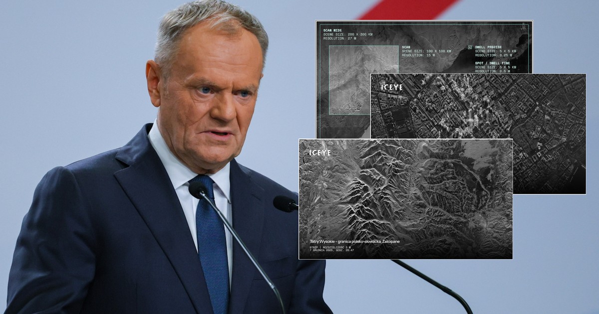
Prime Minister Donald Tusk also posted an example photo on his social media, thanking the president of ICEYE and commenting: “Let's keep going!”
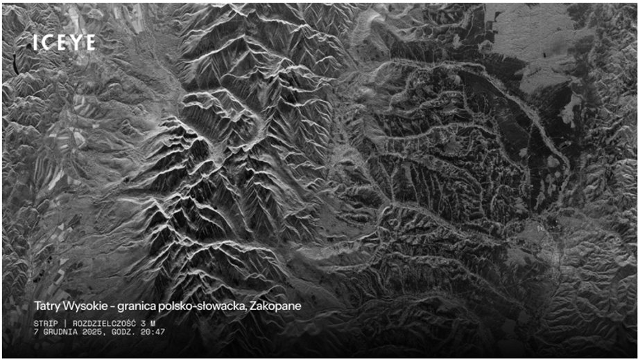
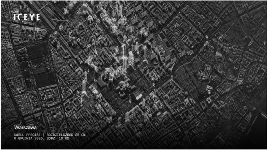
As reported by ICEYE the first Polish military satellite began producing images on December 2. Below are various imaging modes – from monitoring large areas to precise observations of single objects.
|
ICEYE
|
ICEYE

|
ICEYE
“Each satellite operating mode has been developed with a different application in mind – from observing wide areas, through medium-detail shots that enable, for example, monitoring borders and maritime traffic, to high-resolution images that allow you to see changes at the level of individual objects,” ICEYE points out.
See also: The first Polish military satellite is already in orbit. The president comments on the historic moment
The first satellite of the Polish Armed Forces. What is SAR radar?
The ICEYE satellite of the Polish Armed Forces is equipped with a synthetic aperture radar (SAR), which sends short microwave pulses towards the Earth, and then combines and processes their reflections, creating detailed images with a resolution of up to 25 cm per pixel.
SAR technology allows the satellite to “see” day and night, and microwave waves penetrate clouds, smoke and fog. This makes it possible to precisely detect objects and changes in the terrain, regardless of the weather. Because radar satellites do not use visible light, the image is monochromatic.
See also: The contract for almost a billion has been signed. “Poland gains independence”
Weather resistance and 24/7 imaging capability make SAR an ideal tool for military and crisis management applications.
Sovereign reconnaissance capabilities of the Polish Armed Forces
The satellite from which the first photos come is part of the military MikroSAR program, under which ICEYE will provide the Polish Armed Forces with three radar satellites, with the option of expanding the constellation with another three units. Only six months passed from the signing of the contract in May 2025 to the launch of the first satellite into orbit.
After completing the tests, the MikroSAR system will become one of the key elements in building sovereign national satellite reconnaissance capabilities, increasing the situational awareness of the Polish Army and the speed of response to potential threats.
ICEYE – what company is this?
ICEYE specializes in building dedicated satellite constellations and providing data and analytical products applicable, among others, to: in defence, crisis management, agriculture and climate change research.
The company owns and operates the world's largest commercial SAR satellite constellation, providing access to the highest resolution and revisit rate radar data. Since 2018, the company has placed 62 satellites in orbit for its own and customers' needs. In 2025 alone, there were 22 of them.