Satellites and lasers in the service of the Tatra Mountains. A massive monitoring project is being launched
2026-05-03 18:00
publication
2026-05-03 18:00
The Tatra Mountains will be covered by a modern, precise nature monitoring system based on aerial and satellite data and laser scanning – informed the Tatra National Park (TPN). New technologies are intended to enable precise spatial management of the entire ecosystem, explained TPN.
As Marcin Bukowski, head of the Department of Scientific Research and Nature Conservation Planning at TPN, emphasized, the new data will allow, among others, for “precisely locating invasive species hotspots and their spot removal, monitoring the overgrowing of clearings and planning active protection measures, as well as early detection of trail erosion before serious damage occurs.” The system will also enable the identification of dead trees near trails and quick assessment of the effects of windfalls and avalanches.
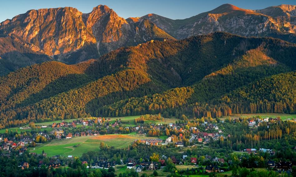
Monitoring will cover the entire area of the Tatra Mountains – over 21,000. hectares – also in hard-to-reach areaswhich have so far been studied only fragmentarily. The data will be obtained, among others: from airborne laser scanning (ALS), hyperspectral imagery and satellite data, and then processed into 3D models and thematic maps.
Multi-time analyzes are to be an important element of the project. The new data will be compared with archival measurements, which – as Bukowski pointed out – will allow “to move from reacting to the effects to earlier recognition of processes and planning protective actions based on long-term trends.” As a result, a digital archive of changes in the Tatra Mountains will be created, which will also be used in the future as data analysis methods develop.
Referring to the Tatra forests, Bukowski emphasized that monitoring is not aimed at “fighting” phenomena such as the death of spruce trees, but at better understanding them. As he explained, in the Tatra Mountains, processes such as bark beetle outbreaks or windfalls are an element of the natural dynamics of the forest, leading to the renewal of tree stands. Remote sensing data will help distinguish natural processes from those requiring intervention, e.g. in the case of historic spruce monocultures susceptible to disturbances.
The system is intended to support both strict protection – where the observation of natural processes is key – and active protection, enabling precise planning of activities, e.g. reconstruction of non-resistant tree stands. The greatest threats to the Tatra forests today include the effects of climate change, tourist pressure, alien species and disturbances in water relations.
Bukowski also emphasized that project results will be made widely available. The data is to be sent to geoportals and internet applications.
– We want it to be not only raw data, but understandable studies showing how the Tatra Mountains are changing, Bukowski pointed out.
As part of the project, the park purchased a drone with the RTK (Real-Time Kinematic) system in 2025, and the remaining IT equipment – including workstations and spatial data processing systems – is to be delivered in the second quarter of 2026.
The project is implemented under the European Funds for Infrastructure, Climate, Environment 2021-2027 (FEnIKS) program. The investment is intended to increase TPN's capabilities in environmental monitoring, nature conservation planning and sharing scientific and educational data. The total value of the project is over PLN 7 million, of which PLN 6 million comes from European Union funding and PLN 1 million is national co-financing from the National Fund for Environmental Protection and Water Management. (PAP)
szb/ mmu/