MAP Bucharest has the most consistent snow cover, after the new episode of blizzard and snow. What awaits us next week
Meteorologists did not issue new warnings and announced that the weather will change considerably in the coming days. The new episode of blizzard and snow has left behind a new layer of snow in the areas under warning, according to the map published by the National Meteorological Administration (ANM).
Bucharest and 16 counties were targeted until Sunday at 10:00 a.m. by a yellow code of snow, blizzard and hail: Olt, Argeș, Teleorman, Giurgiu, Dâmbovița, Ilfov, Prahova, Călăraşi, Ialomița, Buzău, Covasna, Vrancea, Brăila, Galați, Tulcea and Constanța.
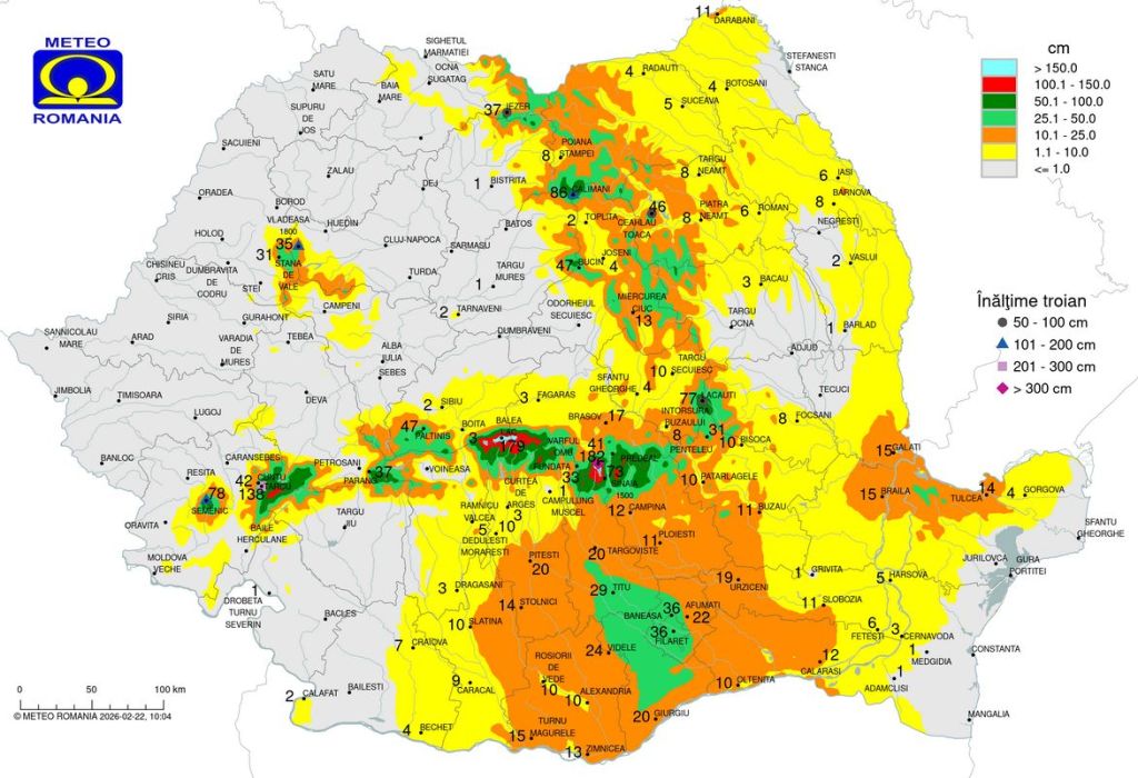
The highest values for the snow cover are recorded in the mountain areas, and on the ridges, trojans of almost 2 meters are reported. In the resorts of Valea Prahova, the layer exceeds 70 cm, in Semenic it is almost 80 cm and in Stâna de Vale 35 cm is recorded.
The biggest layer of snow is at Bâlea Lac (179 cm) and in Bucegi, at Vârful Omu (182 cm).
The south and southeast of the country, covered by a moderate layer
In the south, including Muntenia and Oltenia, the snow cover varies between 3 and 36 cm. In the Capital and its surroundings, the map indicates the greatest snow cover.
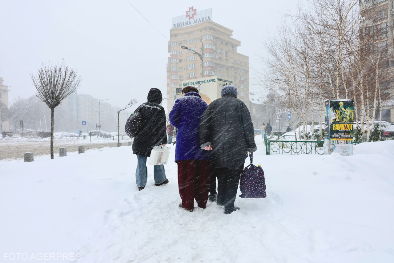
In Bucharest, the snow layer recorded 36 cm on Sunday morning, after the blizzards of the last few days and the previous episode of bad weather.
In the Capital it is the most consistent layer of snow in the lowland areas hit by the two episodes of severe weather in the last week.
The west of the country, less affected
In the east and southeast, including in mainland Moldova and Dobrogea, a layer of 5-15 cm prevails, less in the coastal area, where it did not snow, but there was strong wind.
And in the center of the country, the snow cover varies, with 2 cm in Sibiu, 17 cm in Brașov, 4 cm in Sfântu Gheorge and 10 cm in Târgu Secuiesc.
In the west and northwest, areas that were not under a bad weather warning, the values are lower, below 10 cm, except in mountainous areas, where the layer is significant, such as in the Călimani Mountains, where the layer is almost one meter.
What comes after the blizzard and snow
After the blizzard and snowfall of the last few days, the weather will warm up and rain will follow, mainly in the north, west and center of the country, according to meteorologists.
“A process of improving the weather is starting, definitely, because next week we expect a significant process of warming the weather”, Florinela Georgescu, ANM's forecasting director, told Digi24.
Snow will be possible in the mountains, but temperatures will rise from Monday and reach 14 degrees Celsius in some areas.
“Rather it will be rain in the western, north-central part of the territory, mixed precipitation in the south-southeast, the northern part. It is possible that it will still snow in the mountains, but only on higher ridges, and the warming process will materialize through temperatures reaching 12, maybe 14 degrees in the west-central part of the territory, between 5 and 10 degrees in the other regions”, she added.