Severe weather until Monday evening: orange and yellow storm code and hail / how the rains advance
Meteorologists have issued new orange and yellow code alerts of atmospheric instability for dozens of counties valid on Sunday, August 17, until Monday evening, August 18th. At the same time, today, several counties in the south of the country, including Bucharest, are under alert.
On Sunday (August 17), in the south of Oltenia, southwest and center of Muntenia will be a yellow code of heat. The maximum temperatures will be 35 … 36 degrees.
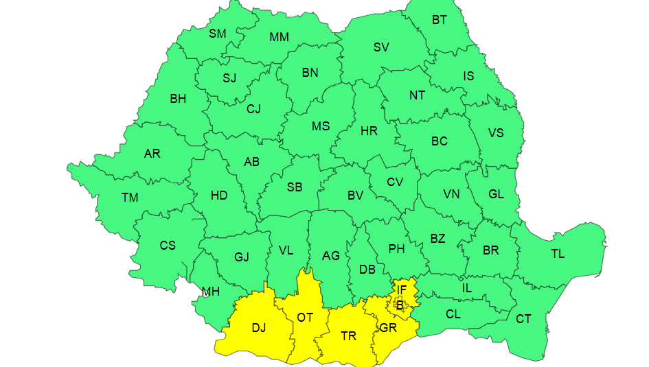
Also, ANM issued a yellow storm code and vijelii, valid between August 17, at 12 – 17 August, at 21.
Targeted are Transylvania, Maramureș, Banat, northwest of Moldova, as well as the mountain area. Here, there will be periods with atmospheric instability that will manifest through torrential showers, electric discharges, wind intensifications, vijections (rags of 50… 70 km/h) and on restricted areas of small and possibly average dimensions (1 – 3 cm).
In short intervals and by accumulation, the quantities of water will be 20… 30 l/sqm and isolated over 40… 50 l/sqm.
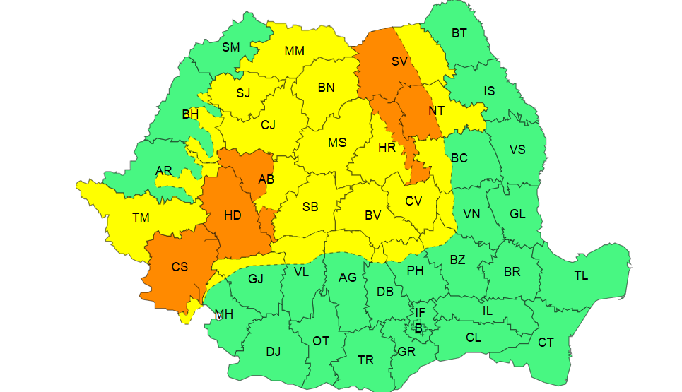
Also today, from 14.00 until 21.00, an orange code for vigils and strong rains is in force.
Visa are the counties of Caraș Severin and Hunedoara, as well as the mountain area of Cluj, Alba, Suceava, Neamț and Harghita counties.
Here will be quantitatively significant showers, frequent electric discharges and on restricted areas strong wind intensifications (gusts of 70 … 90 km/h) and medium and possible size (3 – 5 cm). In short intervals or by accumulation, the quantities of water will be 40… 50 l/sqm and isolated over 60 l/sqm.
Strong storms until Monday night
Subsequently, from 21.00 until tomorrow morning, at 10.00, two other orange and yellow storm alerts enter into force.
Under the yellow code there is most of Transylvania and the local center of Moldova, where there will be periods with atmospheric instability that will manifest through torrential showers, electric shocks, wind intensifications (gusts of 50 … 55 km/h) and isolated small hail (1 – 2 cm). In short intervals of time or by accumulation, the quantities of water will be 20… 25 l/sqm and isolated over 35… 40 l/sqm.
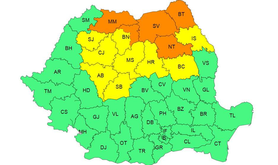
Under the orange code are the counties of Maramureș, Suceava, Botoșani and Neamț, as well as the mountain area of Bistrița-Năsăud county. In short intervals or by accumulation, the quantities of water will be 40… 50 l/sqm and isolated over 60 l/sqm.
Subsequently, another yellow storm code will enter into force tomorrow, from 12.00, until 23.00, this time in Oltenia, southern Transylvania, as well as in the northwest of Muntenia and in the Southern Carpathians.
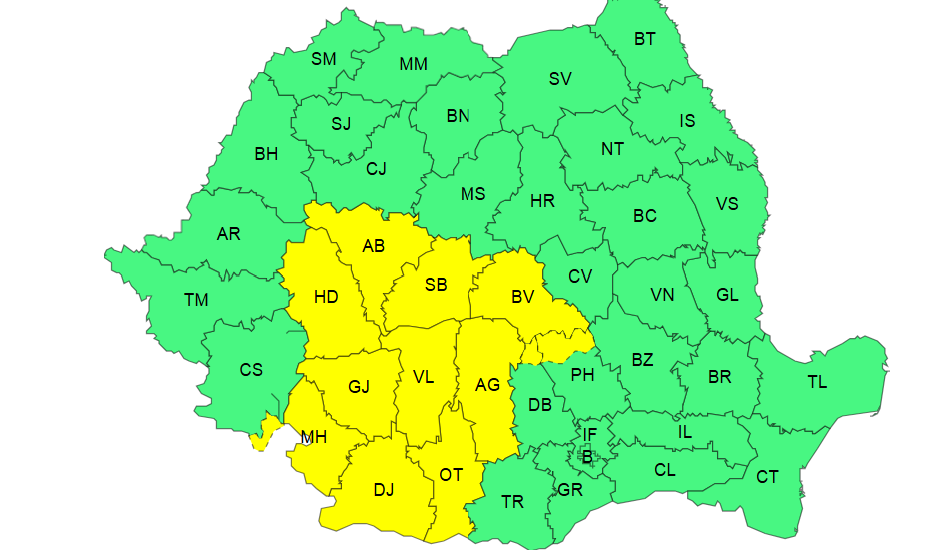
Here, there will be periods with atmospheric instability that will manifest through torrential showers, electric discharges, wind intensifications (gusts of 50… 70 km/h) and isolated small and possibly medium dimensions (1 – 3 cm). In short intervals or by accumulation, the quantities of water will be 20… 30 l/sqm and on restricted areas of over 40 l/sqm.