Severe weather weather alert. Yellow code for snow and blizzard in Bucharest and 16 counties now issued by ANM / New layer of snow
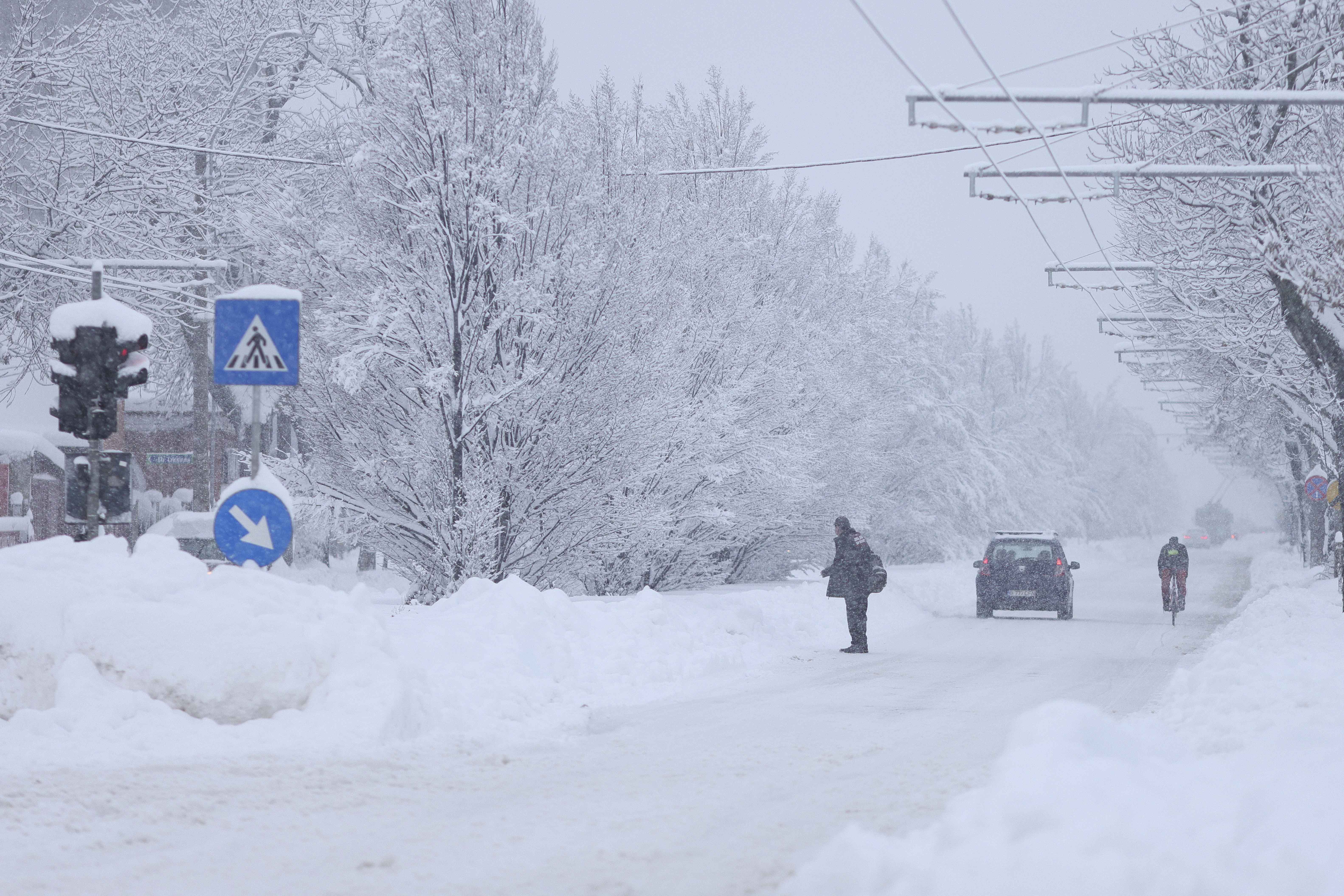
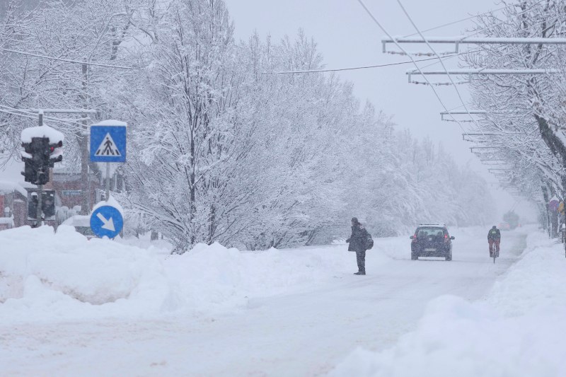
Car and pedestrian traffic in difficult conditions caused by massive snowfall and consequences of the red snow code, in Bucharest, February 18, 2026. Inquam Photos / Octav Ganea
Meteorologists issued a new severe weather warning on Friday morning. It will snow again in the Capital and 16 other counties, which are subject to a yellow code of snow and blizzard, and a new layer of snow will be deposited. The weather will also gradually cool across the country.
According to ANM, starting from Friday at 10:00 a.m. until Sunday, February 22, at 10:00 a.m., a meteorological information is valid for quantitatively moderate precipitation, hail, ice, snow cover, wind intensifications, blizzard and cold weather.
During this interval, the area of precipitation will expand from the western regions and cover most areas. Rains will prevail in Banat and Crisana, and in Moldova and in the mountains it will snow.
In the rest of the territory, during Friday (February 20) there will be mostly rain, but from the evening of Friday until Sunday morning, snow will prevail.
Local water quantities will be 15…20 l/sq m and isolated over 25 l/sq m. On small spaces, ice and ice will form. A layer of snow with an average thickness of 5…15 cm will be deposited.
The weather is getting colder in most of the country
On Friday (February 20) the wind will have temporary intensification in the western and mountain regions, then from midday until Saturday evening (February 21) and in the eastern and southeastern ones. There will be speeds in general of 40…55 km/h, and at high altitudes gusts will reach 70…90 km/h. In the southeast of the country, there will be a temporary blizzard and reduced visibility.
On Friday (February 20) the weather will be cold in the northern half of Moldova, so the maximum temperatures will fall between -3 and 2 degrees.
The minimum temperatures in the country from the night of Friday to Saturday (February 20/21) will be between -12 and 4 degrees, with the lowest values in northern Moldova and northeastern Transylvania.
Saturday (February 21) will cool across most of the country, becoming particularly cold in the south and east where maximum temperatures will be between -5 and 1C.
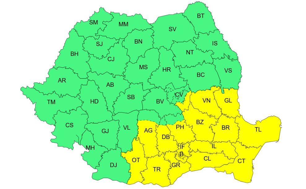
Yellow code for snow and blizzard in Bucharest and 16 counties
ANM has also issued a yellow snow and blizzard code for the Capital and 16 counties that will come into force on Friday, February 20, at 12:00 and will be valid until Sunday, February 22, at 10:00.
The 16 counties affected by the bad weather warning are: Olt, Argeș, Teleorman, Giurgiu, Dâmbovița, Ilfov, Prahova, Călărași, Ialomița, Buzău, Covasna, Vrancea, Brăila, Galați, Tulcea and Constanța.
From the afternoon of Friday (February 20) until Saturday evening (February 21) the wind will intensify, at first in the south of Moldova, Muntenia, in the Carpathians of Curbură, then also in the southeast of Oltenia and Dobrogea. There will be gust speeds of 50…60 km/h and local 65…70 km/h.
From the night of Friday to Saturday (February 20/21) there will be quantitatively significant precipitation, at first mixed, so that sleet and ice will form locally, then it will snow (except for the coastal area where it will rain). It will be blizzard and visibility will drop below 100m.
Accumulated water quantities will be 15…30 l/m2 and an uneven layer of snow will be deposited, generally 15…20 cm thick.