“Every great investment starts with smaller steps. Before the heavy equipment comes in, even the construction of the metro looks quite modest,” wrote Rafał Trzaskowski, the 10th mayor of Warsaw, in a post on the social networking site.
“We have started geological drilling for the construction of the fourth line of the Warsaw metro. You will see more such points in the urban space in the coming months – In total, we will carry out approximately 1,450 drillings and soundings. We will examine the ground beneath the surface to select technological solutions. All this to ensure safe construction later. — emphasizes the mayor of Warsaw.
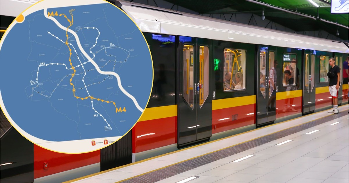
From north to south. The fourth metro line in Warsaw
Planned the fourth metro line in Warsaw, 26 km long, is to be operated completely autonomously, with three types of stations. It will connect Białołęka with Wilanów.
The route will also run through Bielany, Żoliborz, Wola, Ochota and Mokotów.
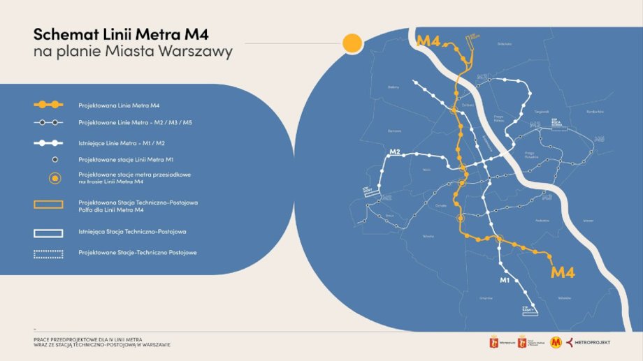
The fourth metro line in Warsaw on the map.
|
UM Warszawa / Press materials
A total of 23 stations are planned on the route: Myśliborska, Obrazkowa, Płochocińska, Ruda, Marymont (transfer with the M2), Rydygiera (transfer with the railway), Rondo Radosława, Cmentarz Żydowski, Okopowa, Rondo Daszyńskiego (transfer with the M2), Plac Zawiszy (transfer with the railway), Plac Narutowicza (transfer with the M5), Bitwy Warszawskiej 1920 r., Wiślicka, Żwirki i Wigury (transfer with M3 and railway), Służewiec (transfer with railway), Rondo Unii, Smoluchowskiego, Wilanowska (transfer with M1), Dolina Służewiecka, Patkowski, Sobieskiego and Wilanów.
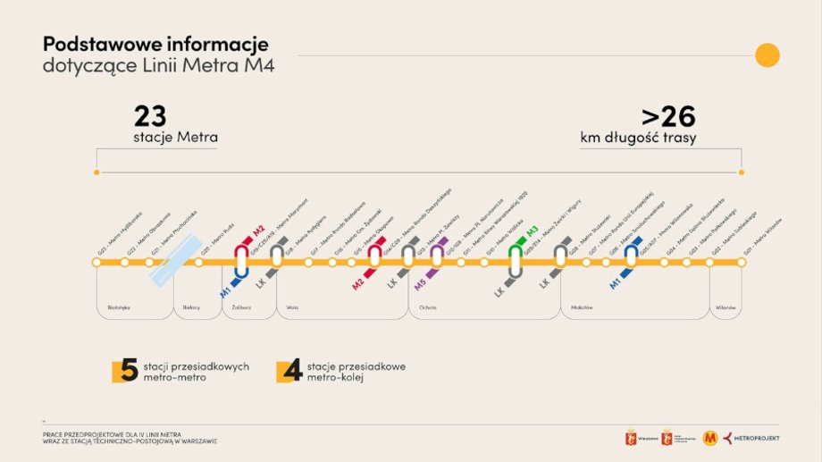
Diagram of the planned fourth metro line in Warsaw.
|
UM Warszawa / Press materials