Mediterranean cyclone and extreme cold wave in Romania. Snow, sleet and minimum temperatures of up to -18 degrees Celsius

A Mediterranean cyclone will affect the south and south-east of Romania, bringing mixed precipitation, snow and ice, followed by an extreme cold wave that will quickly spread nationwide. Temperatures will drop to -15 degrees Celsius in the north and east of the country, and the snow cover will reach 15 centimeters locally, warns the National Meteorological Administration (ANM).
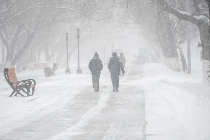
Forecasts and weather alerts are constantly updated. PHOTO: Shutterstock
At the European level, meteorologists are monitoring a North Atlantic extratropical cyclone with an extremely low central pressure of about 970 hPa and a well-developed vertical structure extending into the upper troposphere. The system, named Goretti, has already produced wind gusts of more than 150–200 km/h in western Europe, triggering several code red and orange alerts.
In the context of this cyclone, an Azoric anticyclone is taking shape in the south of the continent, which transports warm tropical air from the north of Africa. In contrast, eastern Europe is influenced by an active depression system, which crossed Romania and generated mixed precipitation, sleet, snow, sleet, wind intensifications and snowpack deposition in several regions.
In the coming days, atmospheric circulation will remain intense across Europe, with several low pressure cores arranged from west to east. Cyclone Goretti will follow a south-southeast trajectory, gradually weakening in intensity, while new cyclogenesis processes will be favored in the Mediterranean basin.
At the same time, the depression system in eastern Europe will move retrograde, integrating into an extended depression area in the eastern half of the continent.
This atmospheric configuration will favor a predominantly northerly and northwesterly circulation, causing polar air to penetrate to southern latitudes. Although there will be brief episodes of temporary warming, the cold air mass will dominate and intensify. In the troposphere, a cold talveg will take shape far down to the south, followed by a dorsade towards the end of the analyzed interval.
Romania will be under the influence of a Mediterranean core, which will initially bring mixed precipitation and poles in Banat, Oltenia and Muntenia, on the night of Friday to Saturday, 9 to 10. Later, against the background of the intensification of the polar air mass, isotherms of -15 to -10 degrees Celsius will be recorded at the level of 850 hPa, which will generate particularly cold weather in most regions.
Precipitation will be mainly in the form of snow, with snow deposits of 5-15 centimeters, especially in the south and southeast of the country, especially during the night of Saturday into Sunday. The accentuated thermal differences and the baric gradient will favor wind intensifications, temporarily associated with blizzards or the shattering of the snow cover. In the southeast, gusts will reach 40–50 km/h on January 10, and in the southwest and in mountainous areas wind speeds will reach 50–60 km/h, on the ridges even 80–90 km/h.
The core of cold air located near the border with Ukraine will advance towards Romania, generating important thermal anomalies, with values far below the climatological averages of the period. ANM has issued a yellow code for northern Moldova and eastern Transylvania, where minimum temperatures between -14 and -10 degrees Celsius are forecast, as well as persistent frost throughout Saturday, when the maximums will not exceed -10 degrees.
A second yellow code is valid between January 10, 20:00 and January 12, 10:00, for Banat, Crisana, Maramureș, Transylvania, Moldova and the mountain area. The maximum temperatures will be between -12 and -3 degrees, and the minimum between -18 and -6 degrees Celsius. The frost will persist even during the day, and the negative temperatures will gradually expand in all regions, starting from Sunday night to Monday.
Meteorologists warn that on Monday and Tuesday (12–13 January) the weather will remain particularly cold, with severe frost at night and in the morning, especially in the north of the country, although there is still the possibility of a slight warming after this period.
ANM announces that weather forecasts and alerts are constantly updated and recommends increased caution, especially for road trips, areas exposed to blizzards and for people vulnerable to extremely low temperatures.