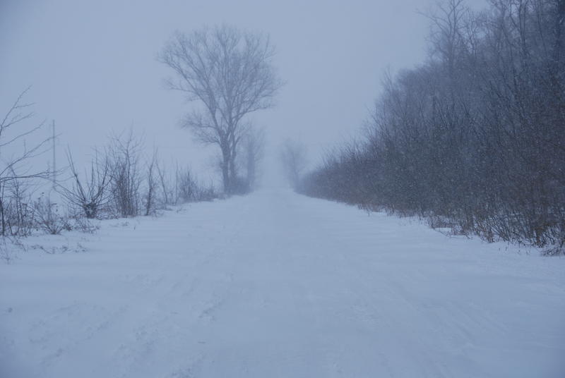
The National Meteorological Administration has issued an orange blizzard code for the mountain area of two counties, where the wind can reach speeds of 120 kilometers per hour.
The NMA has issued a nowcasting code orange warning that is valid until midnight Friday through Saturday.
The targeted counties are Caraș-Severin and Hunedoara, more precisely the areas at altitudes higher than 1,800 meters.
“It will be reported: Snow accompanied by strong wind with a gust of 85-120 km/h, which causes the visibility to drop below 50 m”, the meteorologists report.
Half of the country will be affected by bad weather
On Friday morning, meteorologists issued three yellow code alerts for quantitatively significant precipitation, strong wind and blizzard snow in the mountain area, valid for many counties in the country, until March 30.
The first bad weather code yellow is valid from March 27, 10:00 a.m. to March 30, 10:00 a.m., in more than half of the country.
In the mentioned interval in the south of Banat, Oltenia, Muntenia, Dobrogea and in the greater part of Moldova it will rain quantitatively.
There will be mostly showers, accompanied by isolated electrical discharges in the afternoon and evening of Friday (March 27) and throughout the day on Saturday (March 28).
Rainy and windy weather all weekend
ANM also issued a weather information of wind intensifications, quantitatively moderate rains, in the mountains, at high altitudes snow, snow cover and blizzard, until March 30.
Thus, there will be temporary wind intensifications on Friday (March 27) and during Saturday (March 28) in most of the country, and on Sunday (March 29), in the southeast and in some places in the west, with speeds generally of 45…55 km/h. In the mountains, especially at high altitudes, there will be gusts of over 70…80 km/h.
The rains will spread from the southwest and gradually cover all regions. In the mountains, at altitudes higher than 1600 m, at first in the Southern Carpathians, then in the rest of the mountain areas it will snow, a layer of snow will be deposited, locally consistent and there will be blizzards. By the end of the interval, water quantities of 20…25 l/m2 and locally over 40…60 l/m2 will accumulate. The rains will also have a downpour character, and in the southwest and south, on Friday and Saturday, there will be electrical discharges in limited areas.