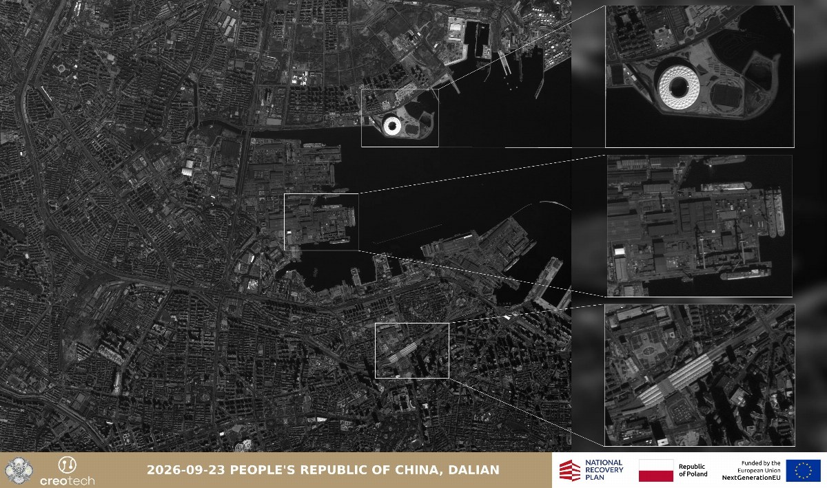
Recent images from a Polish reconnaissance satellite, launched in July, have revealed a Chinese aircraft carrier in construction, along with what appear to be compartments for its nuclear reactors, according to the satellite’s producers.
The high-resolution image is part of a series recently released by the Mikroglob-1 satellite, capturing details from a port in Dalian, located in northeastern China, as reported by TVP.
The Polish aerospace firm Creotech Instruments, which manufactured the satellite, announced the images on social media platform X, stating that “Poland now has its own eyes in orbit.”
Creotech added that the Mikroglob project “strengthens Poland’s sovereign capabilities in satellite technology, domestic expertise, and national security.”
Highlighting the satellite’s practical application for military analysis, the company noted that the Dalian shipyard shows “a particularly interesting object,” where China is building its fourth aircraft carrier.
“It is likely to be equipped with two nuclear reactors, whose compartments, still uncovered, are clearly visible in the image,” the company elaborated.
Grzegorz Brona, the chairman of Creotech’s board, stated in a company announcement that “the initial images represent an important milestone.”
“This is the first time we can publicly present data collected by a satellite that is part of the Earth Observation System we are building,” he added.
The company indicated that one of the key features of the Mikroglob-1 satellite is its ability to capture images across a wide range of wavelengths in the visible light spectrum and near-infrared.
Creotech showcased this capability through another set of photographs of the American city of New Orleans, where the satellite took two images of the same area—one using standard parameters for color photos and another set for infrared.
The infrared photograph, which shows large portions of the captured area bathed in shades of red, can be used to analyze vegetation and other environmental elements. According to Creotech, this setting can assist in assessing damage caused by natural disasters or military operations.
“The first images from the Mikroglob project practically demonstrate how data obtained from orbit can combine detailed observation of individual objects with analysis of broader areas,” stated Creotech Instruments.
The Mikroglob-1 satellite, placed in orbit in July, is one of four such satellites, with Mikroglob-2, -3, and -4 launched into orbit last week.
This project is part of Warsaw’s efforts to expand its reconnaissance and imaging capabilities from Earth’s orbit and is being carried out in cooperation with Poland’s Ministry of Defense.
Polish Defense Minister Władysław Kosiniak-Kamysz stated on Friday that the launch of the second, third, and fourth Mikroglob satellites represents “another step towards strengthening Poland’s security,” calling the mission a “great success of Polish technological ingenuity.”