
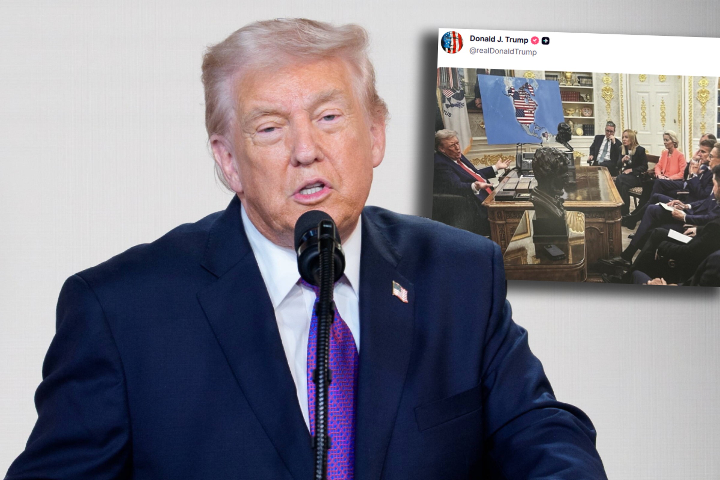
United States President Donald Trump posted on his Truth social media platform on Monday a photoshopped photo from an August 2025 meeting with European leaders and Ukrainian President Volodymyr Zelensky.
The map of Ukraine, then standing in the Oval Office, was replaced by a map of the Western Hemisphere. The American flag in the graphic extends not only to the territory of the United States, but also to Greenland, Canada, Cuba and Venezuela. Donald Trump did not add any comments to the photo.
Why did Donald Trump post a photoshopped photo with a map?
What territories does the map published by Trump cover?
When was the first time Trump posted the same graphic?
What comments accompanied Trump's publication of the photo?
Donald Trump on joining territories to the USA. He wasn't just talking about Greenland
Donald Trump first posted the same graphic on his account in January during a period of tension over the US's pursuit of Greenland. It was one of many memes on the subject posted by the president and the White House.
Donald Trump has repeatedly expressed his desire for not only Greenland, but also Canada, to join the US. After the overthrow of Nicolas Maduro in Venezuela, he declared that the United States would rule the country. He also joked that after the possible overthrow of the regime in Cuba, US Secretary of State Marco Rubio, who has Cuban roots, could become president of this country.


