The satellite was photographed by Airbus Defense & Space's Pleiades satellite, which provides high-resolution images for Google Earth. When it shoots a surface, it actually takes multiple images in different color ranges – blue, green, red, panchromatic and near-infrared. These images are then combined to enhance human visual perception.
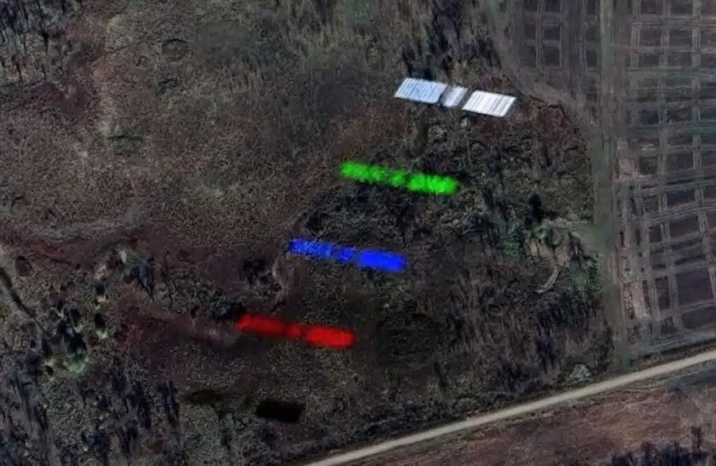
If an airplane crosses the sky during a photo, it appears in these different color ranges. When images are combined, the colors are evened out because the aircraft has time to move significantly between images. However, a satellite in low orbit moves much faster (more than 27 thousand km/h compared to 600–900 km/h for commercial aircraft), which leads to color shifts.
Presumably it was Starlink, although this is not certain – there was also a Chinese satellite nearby. But if so, the image provides a rare opportunity to see a fully deployed Starlink satellite. SpaceX typically releases images of satellites only during their deployment phase at launch.